


")
")


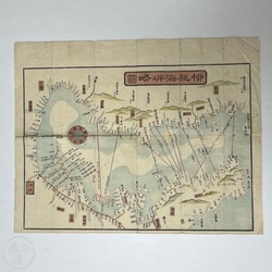


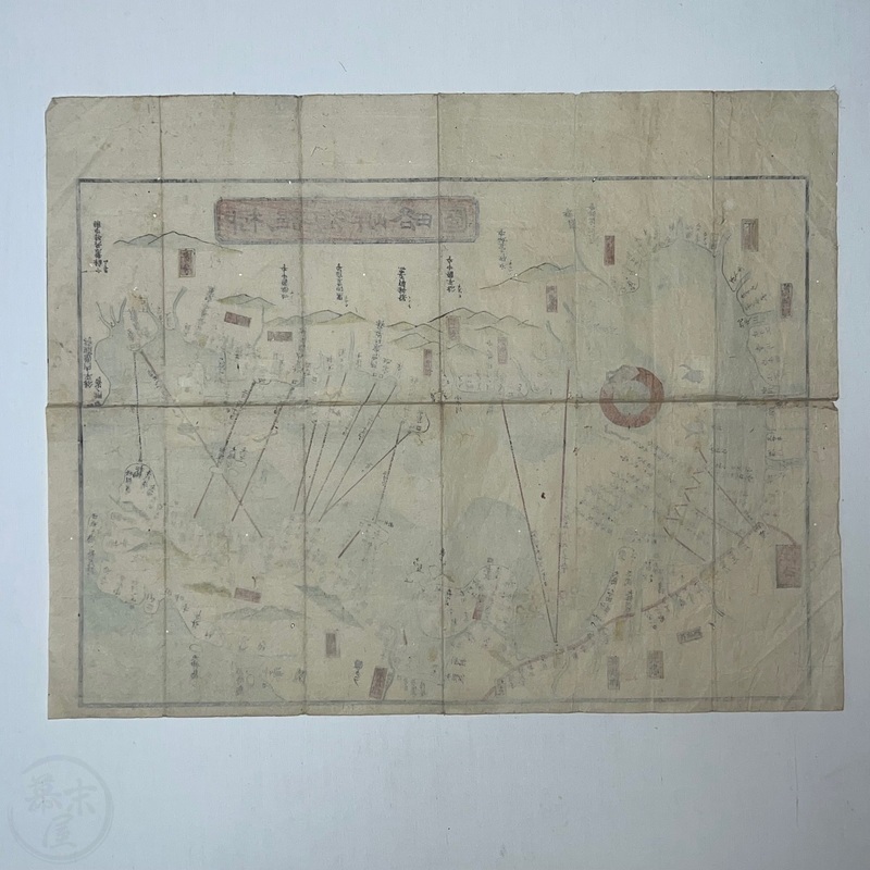
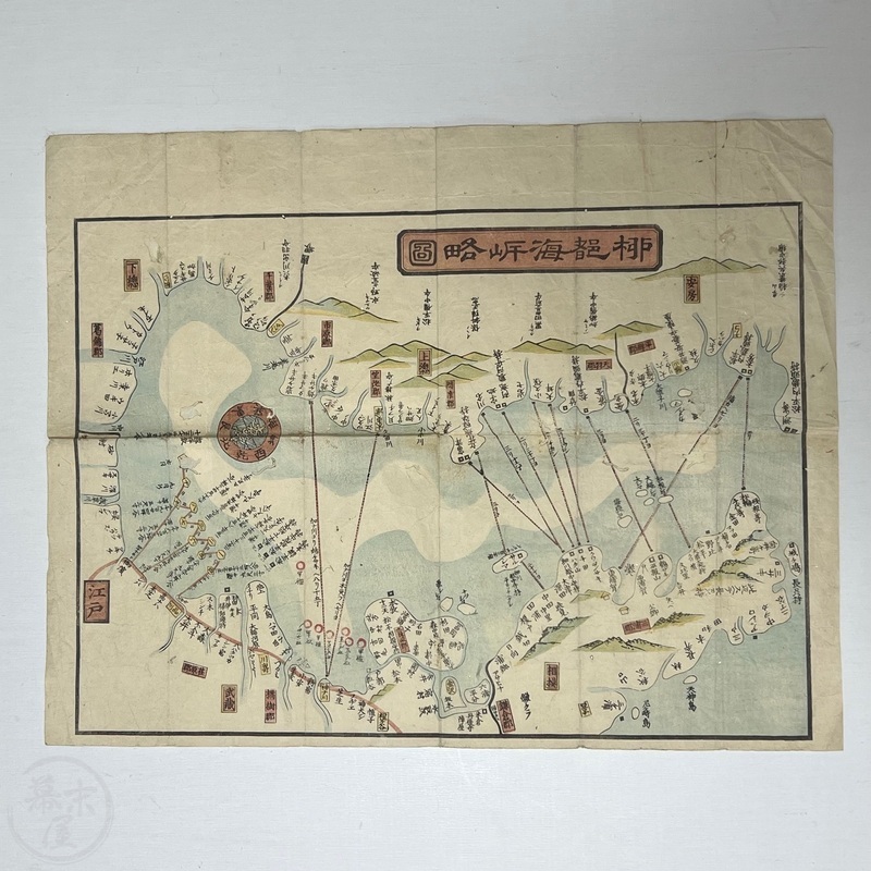
Woodblock Printed Map of Tokyo Bay and Surrounds Late Edo era map with interesting perspective
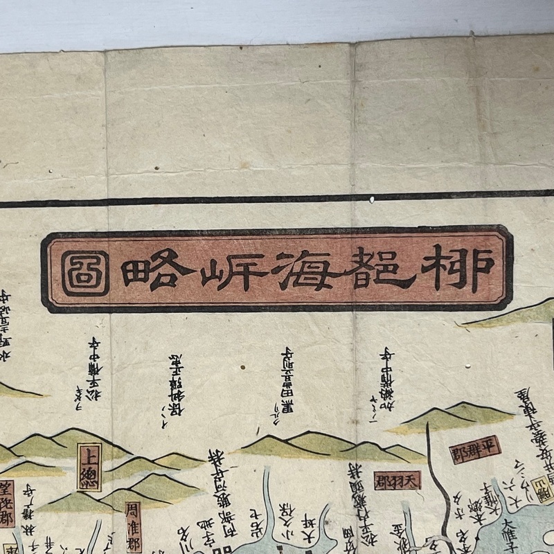
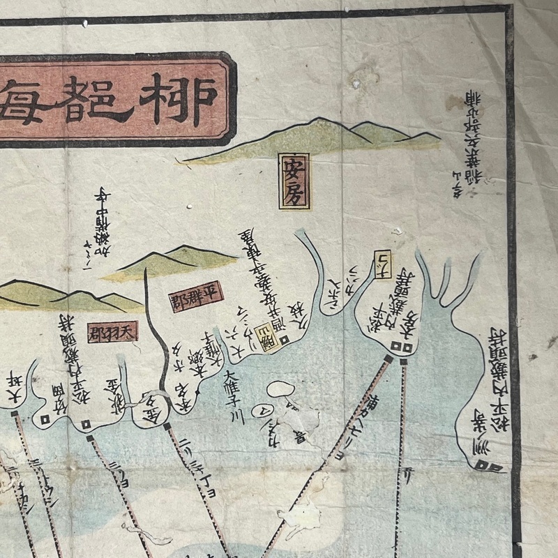
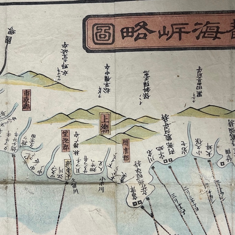
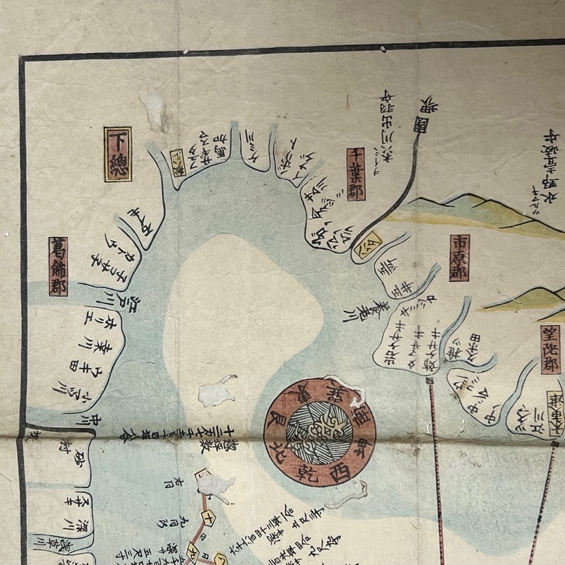
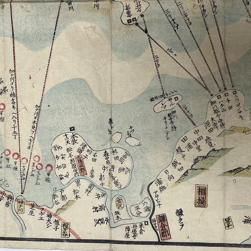
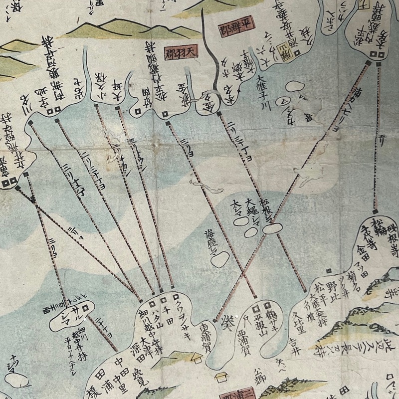
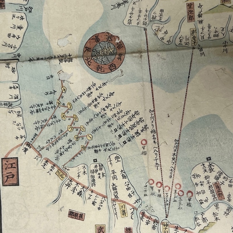
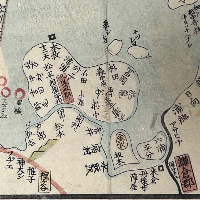
[Japan] Woodblock printed map showing Tokyo Bay and the surrounding area. At lower left we see Edo and the Tokaido with Shinagawa, Kawasaki, Kanagawa and Hodogaya indicated. Interestingly, Noge and Honmoku are mentioned but not Yokohama. It was too small a village to warrant a mention as the map is pre-1859. After Kanazawa (present day Kanazawa Hakkei), we see Kamakura and Sagami. The upper section shows present day Chiba prefecture. The Japanese title is 'Ryuto Kaigan Ryakuzu'.
[No place]. [No publisher]. ND [c1850].
37.5 x 47.5cm.
In good condition. Some wear, creasing, and minor worm trails. A few old repairs to worm holes. Some minor marks and stains but still presents nicely. Unbacked. m37061887