


")
")


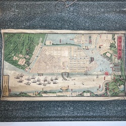
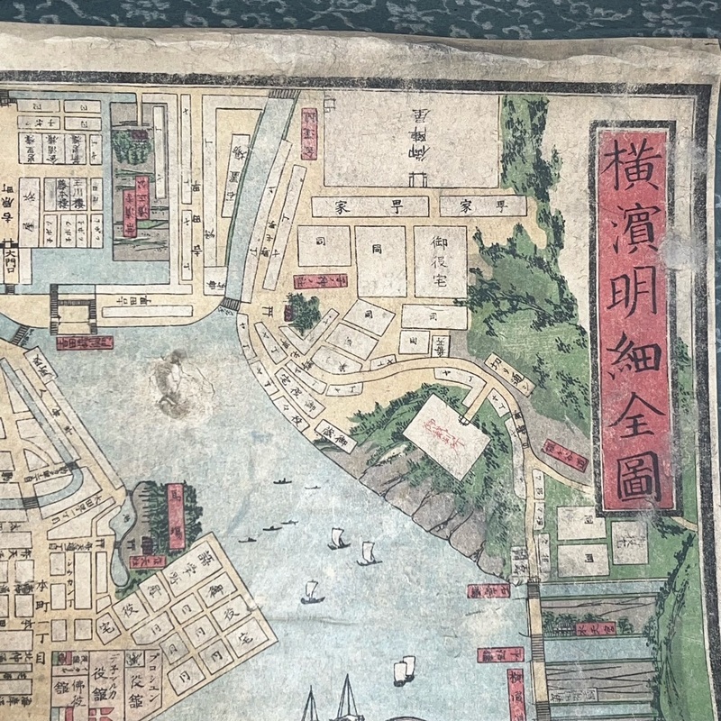
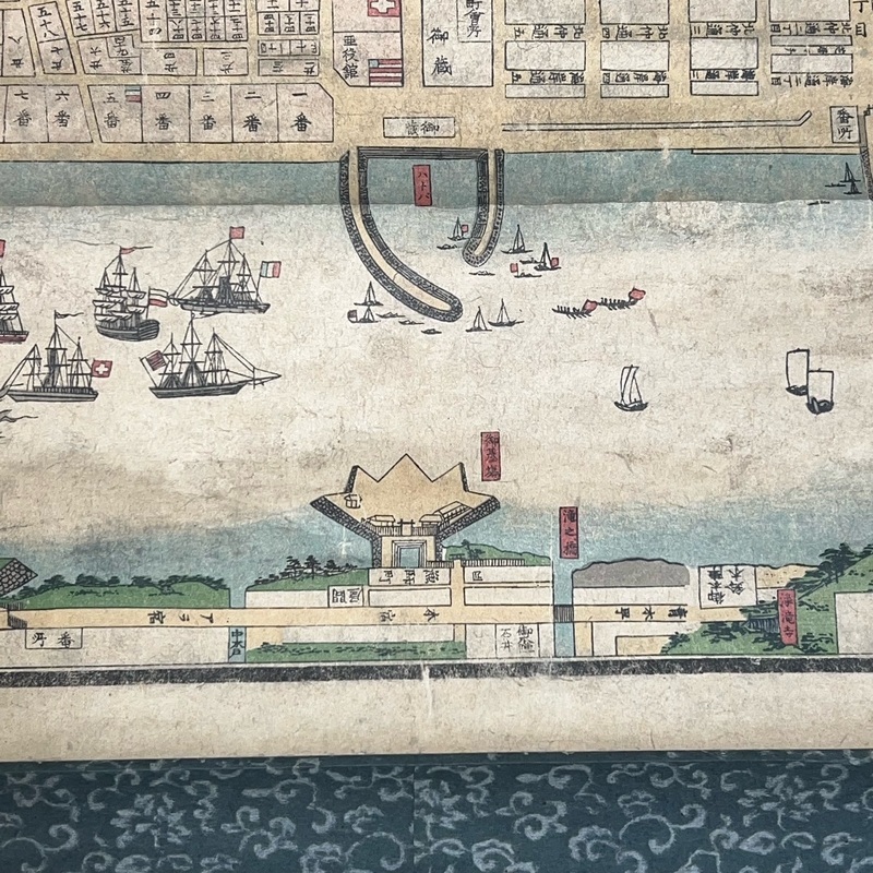
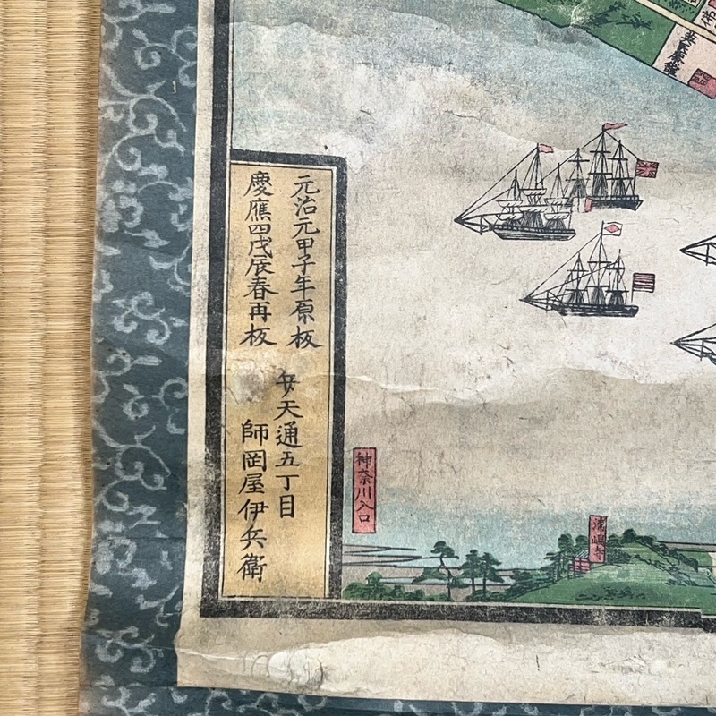
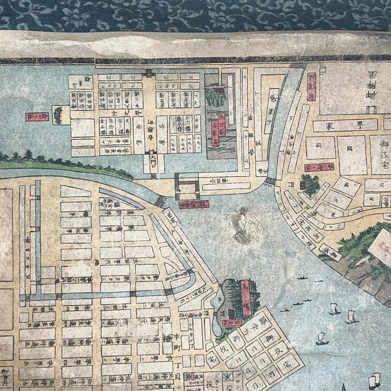
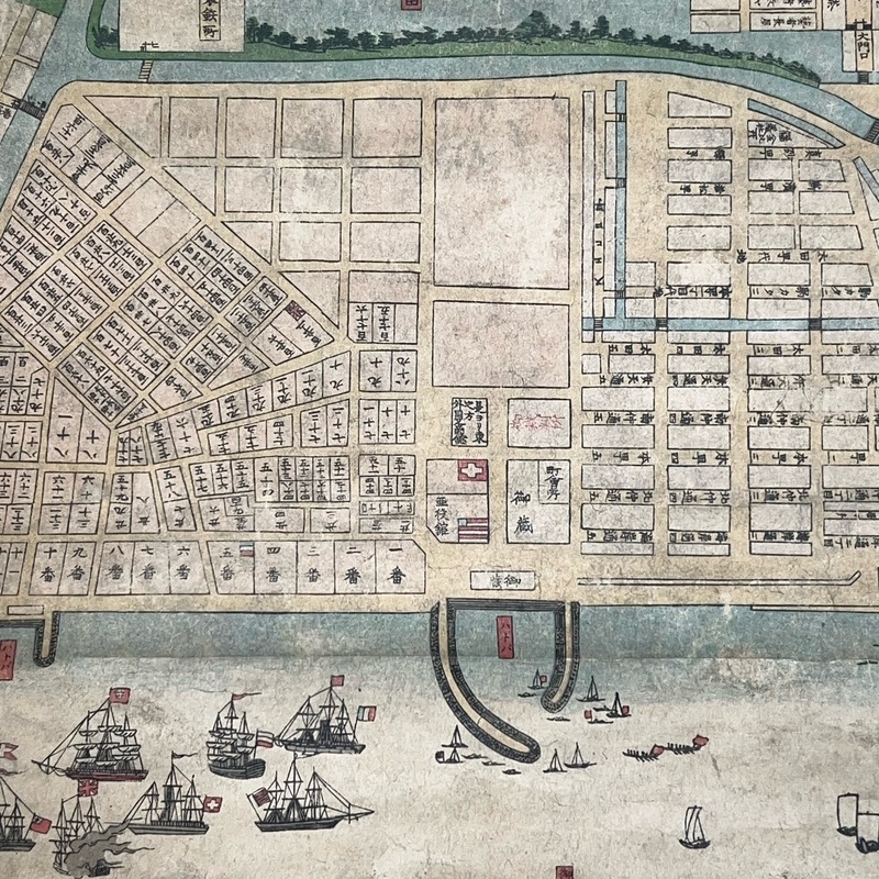
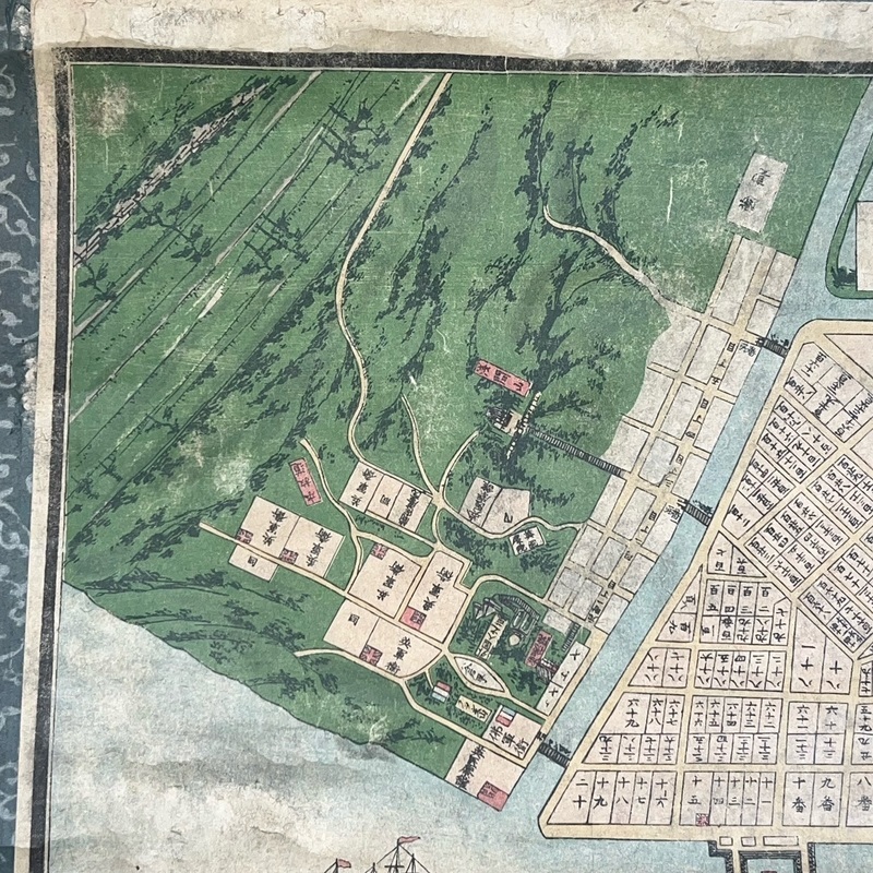
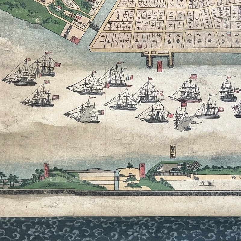
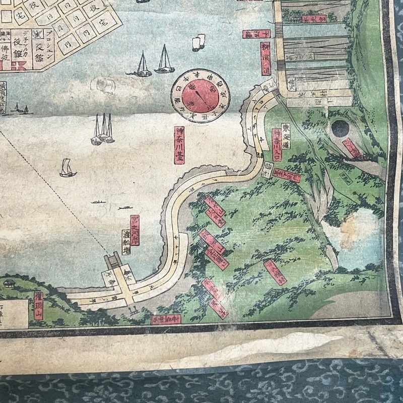
Woodblock Printed Map of Yokohama by Utagawa Yoshikazu
[Japan] Early, woodblock printed map of Yokohama showing the port with numerous vessels and the surrounding area. Yoshikazu produced a number of woodblock prints of foreigners and foreign-related scenes of Yokohama. The colophon states that the map was first published in 1865 and this is an 1868 printing. We have never seen an 1865 edition of the map. The publisher, Morookaya Ihei, also sold other woodblock prints and books targeted at foreigners in Japan. The photographer, Shimooka Renjo, rented a building from Morookaya for his first photo studio in 1862 at No.5 Bentendori.
Bentendori 5-chome [Yokohama]. Morookaya Ihei. 1868.
87.2 x 50.1cm (map size).
Mounted on scroll for hanging. In good condition. General age wear, creasing and some marks. Would display nicely. m31050340